 NERC Data Catalogue Service
Side scan sonar
Type of resources
Topics
Keywords
Contact for the resource
Provided by
Years
Formats
Representation types
Update frequencies
-

These data comprise four phases of geophysical survey carried out in 2002, 2007, 2008 and 2011, covering various areas within the Thames Estuary as part of an overarching archaeological investigation called the London Gateway project (2001-2020) ahead of planned dredging works. 88635_49575_2002 - Area of sidescan sonar data within the Thames Estuary (shell haven) area. The data were acquired in OSGB36 British National Grid coordinates and covers the area: Top Left - 570395.312500 E, 183444.953125 N, Top Right - 604097.250000 E, 183444.953125 N, Bottom Right - 604097.250000 E, 177590.140625 N, Bottom Left - 570395.312500 E, 177590.140625 N. 88635_61207_2007 - Geophysical survey comprising sidescan sonar data acquired over 13 separate wreck sites. Corresponding MBES data were acquired previously in 2005 and are deposited with the UKHO. SSS data comprise a total of 83 .xtf files with 2 channels. Acquired in WGS84 UTMz31N coordinates. 400 KhZ frequency. Range 50 m. Sensor positions rather than ship positions for each line in metadata. Each wreck location is centred on (UTMz31N): Amethyst - 364468 E, 5708659 N; Ancient - 325490 E, 5708230 N; Argus - 359499 E, 5706071 N; Ash - 360905 E, 5706497 N; Atherton - 359708 E, 5706186 N; Dynamo - 401449 E, 5743755 N; EastOaze - 362786 E, 5707385 N; ErnaBoldt - 403551 E, 5746997 N; Letchworth - 357544 E, 5705592 N; London - 343115 E, 5707365 N; Pottery - 346619 E, 5706276 N; SS Storm - 406001 E, 5747115 N; Unknown wreck - 375530 E, 5714052 N. 88635_61208_2008 - Geophysical survey comprising sidescan sonar and multibeam echosounder data over a single wreck site. SSS data comprise a total of 7 .xtf files with 2 channels. 400 KhZ frequency. Range 50 m. Acquired in WGS84 Geographic coordinates. Sensor positions rather than ship positions for each line in metadata. Wreck location in WGS84 UTMz31N: Aisha - 363982 E, 5707656 N. 88635_79800_2011 - Geophysical survey comprising magnetometer, sidescan sonar and multibeam echosounder data undertaken over three separate blocks; Area 9to11, Area 26to36 and Area 105. Area9to11:332980 E, 5708675 N; 332980 E, 5708226 N; 338586 E, 5707813 N; 338681 E, 5708242 N. Area26to36:339693 E, 5708096 N; 339571 E, 5707680 N; 345670 E, 5706229 N; 350490 E, 5706371 N; 350338 E, 5706838 N; 345680 E, 5706685 N. Area105:383734 E, 5719704 N; 384035 E, 5719369 N; 385920 E, 5720804 N; 385619 E, 5721134 N. Where corresponding multibeam echosounder data were acquired, these data have been archived with the United Kingdom Hydrographic Office (UKHO). Overarching full archaeological investigation, including results of the assessment of these data, and technical reports are archived with the Archaeology Data Service (ADS) (https://doi.org/10.5284/1083494).
-
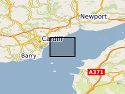
MEDIN Data. Within the project (WFA-CPC EMFF Protecting Our Seas), benthic and geophysical surveys were undertaken in the Severn Esturary/Môr Hafren SAC to explore the location of Sabellaria alveolata reefs, and collected bathymetry, sidescan sonar, AGDS and acoustic imagery data (ARIS) to identify areas of variable ground or potential features. A ten-day survey was undertaken in July 2020 to collect broad-scale acoustic data using an interferometric swath bathymetric system (GeoSwath Plus) and Acoustic Ground Discrimination System (RoxAnn™ AGDS). Twelve secondary survey areas were selected to be investigated in greater detail using high frequency sidescan sonar and an Acoustic Resonance Inspection System (ARIS Explorer 3000) camera in a second ten-day survey conducted in August 2020 (https://www.envision.uk.com/wp-content/uploads/2022/03/2018-1008-NRW-WFA-Protecting_Our_Seas_Final_Report_20210201.pdf) The data sets include: SSS (.tif) collected using Trident SeaStar MBES (.xyz) collected using GeoSwath Plus, AGDS (.csv and .asc) collected using RoxAnn™ AGDS ARIS imagery (.png and .mp4) collected using ARIS Explorer 3000 camera Shapefiles (.shp etc)